Storm Event
High water levels and strong winds bring flooding to Wales, Scotland and western England
Source
The storm developed south of Nova Scotia, Canada on 31st December 2013 and moved northeastwards towards the UK. On 2nd January 2014, the storm approached Ireland and combined with, and was enhanced by, another low-pressure system located south of Iceland. On 3rd January, it then travelled north of Scotland and progressed northwards more slowly, where the central pressure dropped to below 960 mbar. Gusts of between 60 and 70 knots [31 to 36 m/s] were measured along the exposed parts of the west and south coasts of the UK. The highest recorded wind speed was 92 knots [47 m/s] at the Needles Old Battery on the Isle of Wight (Met Office, 2014).
The storm generated a skew surge of between 0.5 and 1 m at many sites on the west and south coasts of the UK. Water levels exceeded the 1 in 5 year return level at 20 sites in these regions; the highest number for any one event within this database. At 7 of these sites, the water level was the highest on record (for respective sites). The highest return period water level was at Portpatrick and was 1 in 244 years. The next largest return period of 1 in 68 years was at Port Erin, Isle of Man. The highest skew surge was at Millport and was 1.07 m.
Wave heights of 4.5 m were forecast in the Irish Sea (Isle of Man Today, 2014). Off the west coast of the UK, wave heights of up to 9 m were recorded for several days before and after January 3rd (AON Benfield, 2014). Along parts of the Scottish coastline, [inshore] wave heights reached up to 1.8 m (BBC, 2014a).
Pathway
The flood pathways during this event were primarily overtopping observed in many locations across the southwest and west coasts.
Receptor and Consequence
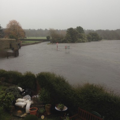
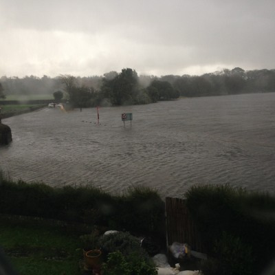
This event was associated with widespread flooding in southwest England, Wales, and Northern Ireland (Haigh et al., 2015). On the Isle of Man, a police station was closed and flooding occurred in many coastal roads and promenades. A minimum of 250 properties were flooded during this event (Watkins, 2014; Natural Resources Wales, 2014). The harbour walls were overtopped by water levels of about 0.8 m over the crest level. In Scotland, about 100 people evacuated their homes (BBC, 2014a). In Lahinch, Ireland, there was extensive structural damage to coastal defences and surrounding businesses were flooded (RTE, 2014). In the southwest of the England there was flooding of streets in Looe, Kingsbridge and Salcombe. In Newquay, part of a coastal road collapsed due to the large waves overtopping the sea wall (Cornish Guardian, 2014). At the River Severn, the banks were overtopped when a large tidal bore arrived and caused ‘several inches’ of flooding of roads and houses in Minsterworth, Maisemore, Elmore and Newnham (BBC, 2014b). On the south coast at Hastings, large parts of the cliffed coastline eroded from the storm wave impacts (Metro, 2014). In north Wales, about 30 properties were flooded causing some people to be trapped at home by water up to waist deep (BBC, 2014c). In Jersey, flooding led to the closure of several roads (Jersey Evening Post, 2014). In combination with a successive Atlantic depression in the following days, approximately 110 coastal defences were damaged in Wales, with an estimated financial impact of £2.8 million (Natural Resources Wales, 2014). The total economic losses were estimated in excess of €75 million.
Summary Table
| Loss of life | * |
| Residential property | Over 250 properties flooded in various locations |
| Evacuation & rescue | Around 100 persons in Scotland evacuated |
| Cost | Total economic losses were estimated at £55 million, although this includes losses beyond flood impacts (i.e. wind-generated) and possibly over a time frame extending beyond this event only |
| Ports | * |
| Transport | Railway track and the Coastal Path in Wales were damaged; flooding of many coastal roads |
| Energy | * |
| Public services | One police station on the Isle of Man closed |
| Water & wastewater | * |
| Livestock | * |
| Agricultural land | 3.5 km2 of agricultural land in Wales either inundated or impacted |
| Coastal erosion | “Large” parts of the coastline in Hastings eroded |
| Natural environment | 37 SSSI’s and 10 SAC’s in Wales impacted (during this event and over preceding/forthcoming days) |
| Cultural heritage | * |
| Coastal defences | * |
*No known sources of information available
Affected Sites
| Name | Return Period ? | Water Level ? | Tide ? | Skew Surge ? | Date ? |
|---|---|---|---|---|---|
| PORTPATRICK | 244 | 5.28 | 4.38 | 0.89 | 3rd Jan 2014 12:30 |
| PORT ERIN | 68 | 6.61 | 5.82 | 0.79 | 3rd Jan 2014 12:30 |
| WORKINGTON | 46 | 9.89 | 9.05 | 0.83 | 3rd Jan 2014 12:30 |
| HOLYHEAD | 20 | 6.73 | 6.14 | 0.59 | 3rd Jan 2014 11:00 |
| ILFRACOMBE | 20 | 10.49 | 10.01 | 0.48 | 3rd Jan 2014 07:00 |
| BARMOUTH | 18 | 6.36 | 5.61 | 0.74 | 3rd Jan 2014 09:15 |
| MILLPORT | 18 | 4.8 | 3.7 | 1.09 | 3rd Jan 2014 13:15 |
| LLANDUDNO | 17 | 8.93 | 8.37 | 0.55 | 3rd Jan 2014 12:00 |
| FISHGUARD | 17 | 5.8 | 5.27 | 0.53 | 3rd Jan 2014 08:00 |
| STORNOWAY | 14 | 5.88 | 5.39 | 0.49 | 3rd Jan 2014 08:15 |
| HINKLEY POINT | 13 | 13.35 | 12.7 | 0.64 | 3rd Jan 2014 08:00 |
| WEYMOUTH | 13 | 2.94 | 2.53 | 0.41 | 3rd Jan 2014 08:00 |
| LEITH | 10 | 6.52 | 5.95 | 0.57 | 4th Jan 2014 16:15 |
| HEYSHAM | 9 | 11.18 | 10.47 | 0.71 | 3rd Jan 2014 12:15 |
| NEWLYN | 9 | 6.31 | 5.96 | 0.35 | 3rd Jan 2014 06:00 |
| ULLAPOOL | 9 | 6.25 | 5.77 | 0.48 | 3rd Jan 2014 08:00 |
| MUMBLES | 9 | 10.73 | 10.21 | 0.52 | 3rd Jan 2014 07:15 |
| TOBERMORY | 8 | 5.72 | 5.05 | 0.67 | 3rd Jan 2014 07:15 |
| LIVERPOOL | 8 | 10.78 | 10.21 | 0.57 | 3rd Jan 2014 12:00 |
| PORTSMOUTH | 7 | 5.49 | 4.9 | 0.58 | 3rd Jan 2014 12:30 |
We rely on submissions from the public to maintain these images. If you witnessed this event, please help by uploading your photos.
References
- Met Office, (2014). ‘Winter storms, December 2013 to January 2014’. Met Office. Available at: http://www.metoffice.gov.uk/climate/uk/interesting/2013-decwind (Accessed: 20 November 2016).
- Isle of Man Today, (2014). ‘NOW WITH VIDEO; Once-in-50-years storm surge. Isle of Man Today’. Available at: http://www.iomtoday.co.im/news/isle-of-man-news/now-with-video-once-in-50-years-storm-surge-flooding-alert-raw-sewage-warning-road-closures-1-6349328 (Accessed: 10 January 2014)
- AON Benfield, (2014). ‘January 2014 Global Catastrophe Recap., London’. Available at: http://thoughtleadership.aonbenfield.com/Documents/20140205_if_january_global_recap.pdf (Accessed: 2 June 2015).
- BBC, (2014a). ‘Flooding continues to threaten UK’. BBC News. Available at: http://www.bbc.co.uk/news/uk-25584221 (Accessed: 10 January 2014)
- Haigh, I. D., Wadey, M. P., Gallop, S. L., Loehr, H., Nicholls, R. J., Horsburgh, K., Brown, J. M., and Bradshaw, E., (2015). ‘A user-friendly database of coastal flooding in the United Kingdom from 1915–2014’. Scientific Data, 2, p.150021. Available at: http://www.nature.com/articles/sdata201521.
- Watkins, D., (2014). ‘The winter storms of 2014: How Cornwall fared’. Cornwall Community Flood Forum AGM, Truro‘.
- Natural Resources Wales, (2014). Wales Coastal Flooding Review Phase 1 Report –Assessment of Impacts, Cardiff.
- RTE, (2014). ‘Major clean-up operation after storms and flooding’. RTE News. Available at: http://www.rte.ie/news/2014/0103/495682-weather/ (Accessed: 10 January 2015)
- Cornish Guardian, (2014). ‘Part of beach Road in Newquay collapses after huge waves batter Cornish coast’. Cornish Guardian. Available at: http://www.cornishguardian.co.uk/beach-road-newquay-collapses-huge-waves-batter/story-20400503-detail/story.html (Accessed: 10 January 2014).
- BBC, (2014b). ‘River Severn bursts banks at Minsterworth after bore’. BBC News. Available at: http://www.bbc.co.uk/news/uk-england-gloucestershire-25588120 (Accessed: 16 January 2014)
- Metro, (2014). ‘Breathtaking moment a chunk of Hasting’ s cliff face breaks into sea’. Metro. Available at: http://metro.co.uk/2014/01/03/breathtaking-moment-a-chunk-of-hastings-cliff-face-breaks-away-into-sea-4248862/ (Accessed: 10 January 2014)
- BBC, (2014c). ‘Storm surge brings flooding chaos moving up Wales’ coast’. BBC News. Available at: http://www.bbc.co.uk/news/uk-wales-25583295 (Accessed: 10 January 2014)
- Jersey Evening Post, (2014). ‘Avenue closed for high tide’. Jersey Evening Post. Available at: http://jerseyeveningpost.com/news/2014/01/04/island-battered-by-hailstorm/weather-6/ (Accessed: 10 January 2014).
- Natural Resources Wales, (2014). Wales Coastal Flooding Review Phase 1 Report –Assessment of Impacts, Cardiff


